Featured partner
Recommended for Chelmsford

ROAVR Group
Tree, ecology, flood risk and topographical surveys for planning applications.
4.9 Google rating
Get a quote
Local experts.
Featured partner
Recommended for Chelmsford
Tree, ecology, flood risk and topographical surveys for planning applications.
4.9 Google rating
Local experts.
Ecological consultancy whose own website states that it is based in Essex and lists…
Ecological consultancy of Essex Wildlife Trust, trading as Essex Ecology Services…
Arboricultural and ecological consultancy with a Kent office at The Watermill, Maidstone…
Ecological consultancy with a trading office at Sudbury Stables, Sudbury Road, Downham,…
Biodiversity net gain in Chelmsford needs to be measured where development could affect habitats in the Chelmsford Central Conservation Area or along the River Chelmer. Chelmsford City Council applies the statutory 10 per cent biodiversity net gain minimum. The Chelmsford Local Plan 2013-2036, through Strategic Policy S4 and Policy DM16, seeks a net gain in biodiversity where possible, but the council has not adopted a higher than statutory standard. After the National Planning Policy Framework published on 17 August 2026, qualifying applications are assessed against the statutory 10 per cent minimum except on a justified site allocation. Gardens and churchyards in the Chelmsford Central Conservation Area, and riverside habitats on the River Chelmer, can support bats, birds and other protected species. Confirm the current validation requirements with the council before submitting.
Local planning authority: Chelmsford City Council
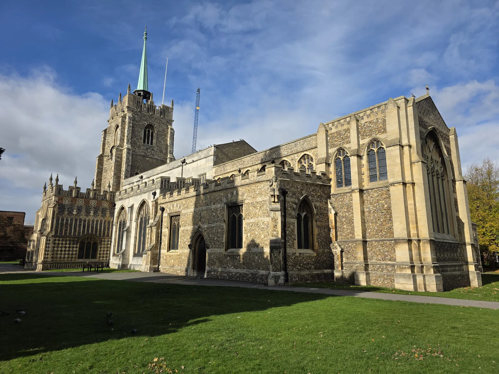
Chelmsford is in the area of Chelmsford City Council. It is the county town of Essex, at the meeting of the River Chelmer and the historic streets around the Chelmsford Central Conservation Area, quite unlike the coastal towns farther south in the county. Chelmsford Central Conservation Area and the River Chelmer are the official features that shape biodiversity net gain work here. Essex County Council is the Lead Local Flood Authority. There is no confirmed 2027 successor council for Essex.
In Chelmsford, including around the Chelmsford Central Conservation Area and the River Chelmer, the same adopted local plan policies apply. Chelmsford City Council applies Strategic Policy S4 and Policy DM16 of the Chelmsford Local Plan 2013-2036, adopted on 27 May 2020, which seek a net gain in biodiversity across the council's area and, where possible, on development sites. The council has not adopted a higher than statutory biodiversity net gain standard, so the statutory 10 per cent minimum applies. After the National Planning Policy Framework published on 17 August 2026, qualifying applications are assessed against the statutory 10 per cent minimum except on a justified site allocation. Confirm the current validation requirements with the council before submitting.
Local plan: Chelmsford Local Plan 2013-2036 (The Chelmsford Local Plan 2013-2036 was adopted on 27 May 2020 and is the statutory development plan as of 15 November 2026.)
DM18: Flooding/SuDS
Only grants planning permission where it can be demonstrated that the site is safe from all types of flooding, now and for the lifetime of the development, and that development does not worsen flood risk elsewhere. All major development must incorporate water management measures to reduce surface-water run-off, with Sustainable Drainage Systems (SuDS) as the principal method.
S4: Conserving and Enhancing the Natural Environment
Commits the council to conserving and enhancing the natural environment through the protection of designated sites and species, planning positively for biodiversity networks and planning for a multifunctional network of green infrastructure, securing a net gain in biodiversity across the council's area. It also provides for contributions towards the Essex Recreational disturbance Avoidance and Mitigation Strategy (RAMS) where appropriate.
DM16: Ecology and Biodiversity
Requires development proposals to conserve and enhance the network of habitats, species and sites, avoid negative impacts on biodiversity and geodiversity, mitigate unavoidable impacts and as a last resort compensate for residual impacts, and to deliver a net gain in biodiversity where possible. The reasoned justification states that the presence of protected species is a material consideration and that the extent to which they may be affected should be established before planning permission is granted.
DM17: Trees, Woodland and Landscape Features
Grants planning permission for development proposals that do not result in unacceptable harm to the health of a preserved tree, trees in a Conservation Area or Registered Park and Garden, preserved woodlands or ancient woodlands, and also considers aged or veteran trees found outside ancient woodlands. Proposals that could affect those trees or woodlands must set out measures to secure their protection.
General guidance for biodiversity net gain (bng), not formal advice for your site.
Chelmsford City Council. There is no confirmed 2027 successor council for Essex. Essex County Council is the Lead Local Flood Authority.
Chelmsford City Council applies the statutory 10 per cent biodiversity net gain minimum. Strategic Policy S4 and Policy DM16 seek a net gain in biodiversity where possible, but the council has not adopted a higher than statutory standard. After the National Planning Policy Framework published on 17 August 2026, qualifying applications are assessed against the statutory 10 per cent minimum except on a justified site allocation. Confirm the current validation requirements with the council.
A biodiversity net gain assessment is often needed where development could affect habitats in the Chelmsford Central Conservation Area or along the River Chelmer. Confirm the current validation requirements with the council.
No other published town guides for this survey in the council area yet.