Featured partner
Recommended for Beaconsfield

ROAVR Group
Tree, ecology, flood risk and topographical surveys for planning applications.
4.9 Google rating
Get a quote
Local experts.
Featured partner
Recommended for Beaconsfield
Tree, ecology, flood risk and topographical surveys for planning applications.
4.9 Google rating
Local experts.
Independent water engineering consultancy whose own site lists a Buckinghamshire office…
A flood risk assessment in Beaconsfield is often needed in the Beaconsfield Old Town Conservation Area or around the Hampden Hill Conservation Area, and on other sites at risk of flooding from rivers, the sea, surface water or other sources. Buckinghamshire Council is the local planning authority. Core Policy 13 is the adopted south-planning-area policy Buckinghamshire Council cites for flood risk assessments and sustainable drainage. It is a South Bucks town with a historic Old Town and the separate Hampden Hill Conservation Area, quite unlike Gerrards Cross to the east or Amersham in the former Chiltern area. Confirm the current validation requirements with the council before submitting.
Local planning authority: Buckinghamshire Council
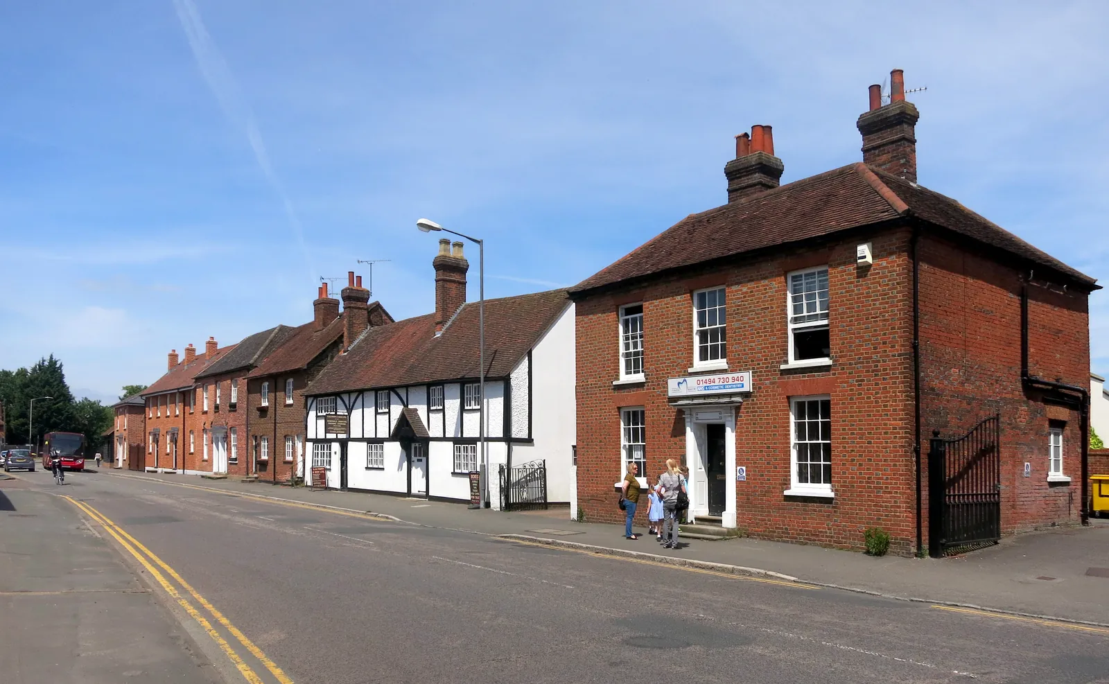
Beaconsfield is in the area of Buckinghamshire Council. It is a South Bucks town with a historic Old Town and the separate Hampden Hill Conservation Area, quite unlike Gerrards Cross to the east or Amersham in the former Chiltern area. The Beaconsfield Old Town Conservation Area and the Hampden Hill Conservation Area are the official features that shape flood risk and drainage work here. Buckinghamshire Council is also the Lead Local Flood Authority. There is no confirmed 2027 successor council for Buckinghamshire or Milton Keynes.
In Beaconsfield, including around the Beaconsfield Old Town Conservation Area and around the Hampden Hill Conservation Area, the same adopted local plan policies apply. Buckinghamshire Council assesses flood risk and drainage under Core Policy 13 of the South Bucks Core Strategy (2011) and South Bucks Local Plan (1999). Core Policy 13 is the adopted south-planning-area policy Buckinghamshire Council cites for flood risk assessments and sustainable drainage. Confirm the current validation requirements with the council before submitting.
Local plan: Predecessor local plans for the former Aylesbury Vale, Wycombe, Chiltern and South Bucks areas (Buckinghamshire Council, which came into effect on 1 April 2020, inherited the local development plan documents for each legacy council. These documents remain relevant to the former district areas. As of 15 November 2026 the statutory local plans are: the Vale of Aylesbury Local Plan, adopted on 15 September 2021, for the north and central planning areas; the Wycombe District Local Plan, adopted on 19 August 2019, and the Delivery and Site Allocations Plan, adopted in 2013, for the west planning area; the Chiltern Local Plan, adopted in 1997, and the Chiltern Core Strategy, adopted on 15 November 2011, for the east planning area; and the South Bucks Local Plan, adopted in 1999, and the South Bucks Core Strategy, adopted on 22 February 2011, for the south planning area. The Buckinghamshire Minerals and Waste Local Plan to 2036, adopted in 2019, applies to the whole council area. A later Buckinghamshire Local Plan had not been adopted as of that date.)
CS4: Ensuring That Development Is Sustainable
Policy CS4 (Ensuring That Development Is Sustainable) of the Chiltern Core Strategy is the adopted policy Buckinghamshire Council cites, with saved Policy GC10 of the Chiltern Local Plan 1997, for flood risk assessments, the sequential test and sustainable drainage in the east planning area.
Core Policy 13: Environmental and Resource Management
Core Policy 13 of the South Bucks Core Strategy is the adopted policy Buckinghamshire Council cites for flood risk assessments and sustainable drainage in the south planning area.
I4: Flooding
Policy I4 (Flooding) of the Vale of Aylesbury Local Plan is the adopted policy Buckinghamshire Council cites for flood risk assessments, the sequential test and sustainable drainage in the north and central planning areas. A flood risk assessment is required in Flood Zones 2 or 3, or on sites of more than one hectare in Flood Zone 1, and a sustainable drainage statement is required for major applications and for other applications that meet the council’s published thresholds.
DM39: Managing Flood Risk and Sustainable Drainage Systems
Policy DM39 is the adopted Wycombe District Local Plan policy that Buckinghamshire Council’s official supporting-information page cites for flood risk assessments, the sequential test and sustainable drainage in the west planning area, together with Policy CP12. A flood risk assessment is required in Flood Zones 2 or 3, or on sites of more than one hectare in Flood Zone 1, and a sustainable drainage statement is required for major applications and for other applications that meet the council’s published thresholds.
CS24: Biodiversity
Policy CS24 (Biodiversity) of the Chiltern Core Strategy says the council will aim to conserve and enhance biodiversity, work with partners to protect legally protected species and sites and networks of habitats, and require development proposals to protect biodiversity and provide for the long-term management, enhancement, restoration and, if possible, expansion of biodiversity. Where, in exceptional circumstances, development outweighs any adverse effect upon the biodiversity of the site and there are no reasonable alternative sites, replacement habitat of higher quality will be provided through mitigation and/or compensation to achieve a net gain in biodiversity. The policy does not set a higher than statutory percentage standard.
Core Policy 9: Natural Environment
Core Policy 9 (Natural Environment) of the South Bucks Core Strategy gives the highest priority to the conservation and enhancement of the natural beauty of the Chilterns Area of Outstanding Natural Beauty and the integrity of Burnham Beeches Special Area of Conservation. More generally, landscape characteristics and biodiversity resources will be conserved and enhanced by not permitting new development that would harm landscape character or nature conservation interests unless the importance of the development outweighs the harm, it cannot reasonably be located on an alternative site, and appropriate mitigation or compensation is provided, resulting in a net gain in biodiversity. The policy does not set a higher than statutory percentage standard.
NE1: Biodiversity and Geodiversity
Policy NE1 of the Vale of Aylesbury Local Plan seeks a measurable net gain in biodiversity on minor and major developments by protecting, managing, enhancing and extending existing biodiversity resources and by creating new ones. If significant harm cannot be avoided, mitigated or, as a last resort, compensated for, development will not be permitted. Where a net loss is calculated, avoidance, mitigation and compensation must be sought so the development results in a net gain, with the percentage of net gain to meet any nationally set minimum standard. Ecological surveys must be undertaken by a suitably qualified person. The nationally set minimum is the statutory 10 per cent; the council has not adopted a higher than statutory standard.
CP10: Green Infrastructure and the natural environment
Policy CP10 (Green Infrastructure and the natural environment) says the council will promote the conservation and enhancement of the natural environment and green infrastructure, including the Chilterns Area of Outstanding Natural Beauty and other natural assets, and will ensure there is a net gain in biodiversity within individual development proposals and across the District as a whole over the plan period. The policy does not set a higher than statutory percentage standard.
General guidance for flood risk and drainage assessment, not formal advice for your site.
Buckinghamshire Council. Buckinghamshire Council is also the Lead Local Flood Authority. There is no confirmed 2027 successor council for Buckinghamshire or Milton Keynes.
A flood risk assessment in Beaconsfield is often needed in the Beaconsfield Old Town Conservation Area or around the Hampden Hill Conservation Area, and on other sites at risk of flooding from rivers, the sea, surface water or other sources. Confirm the current validation requirements with the council.
Core Policy 13 is the adopted south-planning-area policy Buckinghamshire Council cites for flood risk assessments and sustainable drainage. Confirm the current validation requirements with the council.