Featured partner
Recommended for Ely

ROAVR Group
Tree, ecology, flood risk and topographical surveys for planning applications.
4.9 Google rating
Get a quote
Local experts.
Featured partner
Recommended for Ely
Tree, ecology, flood risk and topographical surveys for planning applications.
4.9 Google rating
Local experts.
Consulting engineers whose own site publishes a trading office at Cambridge House,…
Civil engineering consultancy whose own site publishes a trading office at Ground Floor,…
Civil and structural engineering consultancy whose own site publishes a trading office…
Civil and structural engineering practice whose own site publishes an address at 26…
A flood risk assessment in Ely is often needed where work could affect the Ely Conservation Area, or the River Great Ouse. East Cambridgeshire District Council is the local planning authority. Policy ENV 8 requires an overall reduction in flood risk, applies the sequential and exception tests, and requires a site-specific Flood Risk Assessment in Flood Zones 2 and 3 and on larger sites in Flood Zone 1. It is a cathedral city around the official Ely Conservation Area and the River Great Ouse, quite unlike Cambridge, Wisbech or March. The adopted East Cambridgeshire Local Plan Adopted April 2015 (as amended 2023) applies here. Confirm the current validation requirements with the council before submitting.
Local planning authority: East Cambridgeshire District Council
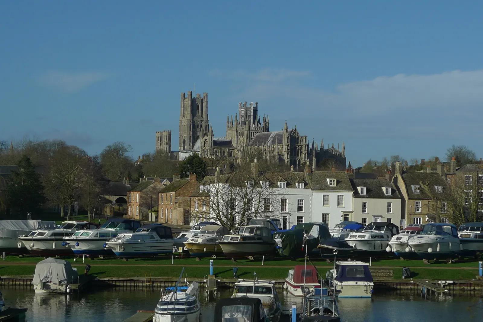
Ely is in the area of East Cambridgeshire District Council. It is a cathedral city around the official Ely Conservation Area and the River Great Ouse, quite unlike Cambridge, Wisbech or March. The adopted East Cambridgeshire Local Plan Adopted April 2015 (as amended 2023) applies here. The Ely Conservation Area and the River Great Ouse are the official features that shape flood risk and drainage work here. Cambridgeshire County Council is the Lead Local Flood Authority. There is no confirmed successor council for East Cambridgeshire.
In Ely, including around the Ely Conservation Area and at the River Great Ouse, the same adopted local plan policies apply. East Cambridgeshire District Council assesses flood risk and drainage under Policy ENV 8 of the East Cambridgeshire Local Plan Adopted April 2015 (as amended 2023). Policy ENV 8 (Flood risk) of the East Cambridgeshire Local Plan Adopted April 2015 (as amended 2023) provides that all developments and re-developments should contribute to an overall flood risk reduction. The sequential test and exception test will be strictly applied, and new development should normally be located in Flood Risk Zone 1. Development will not be permitted where it would intensify the risk of flooding during the lifetime of the development, increase the risk of flooding of properties elsewhere, have a detrimental effect on existing flood defences, cause an unacceptable risk to safety, or where safe access is not achievable during times of flooding, taking into account climate change allowances. A site-specific Flood Risk Assessment is required for major and non-minor development in Flood Zones 2 and 3 and Modelled Zone 3, and for major and non-minor development in Flood Zone 1 on sites of 1 hectare or greater or where there is evidence of historic flooding. The use of Sustainable Drainage Systems will be required for new developments in accordance with the Cambridgeshire SuDs Design and Adoption Handbook, unless character, soil conditions and/or engineering feasibility dictate otherwise. Confirm the current validation requirements with the council before submitting.
Local plan: East Cambridgeshire Local Plan Adopted April 2015 (as amended 2023) (adopted)
ENV 7: Biodiversity and geology
Policy ENV 7 (Biodiversity and geology) of the East Cambridgeshire Local Plan Adopted April 2015 (as amended 2023) requires all development proposals to protect the biodiversity and geological value of land and buildings and minimise harm to or loss of environmental features, such as trees, hedgerows, woodland, wetland and ponds; provide appropriate mitigation, reinstatement or replacement of features and/or compensatory work that will enhance or recreate habitats on or off site where harm is unavoidable; and maximise opportunities for creation, restoration, enhancement and connection of natural habitats as an integral part of development proposals. Applications that may affect biodiversity and geology interests must be accompanied by sufficient information, including an ecological report. Where there is reason to suspect the presence of protected species, trees and woodland, applications must be accompanied by a survey carried out by a qualified individual. The policy does not set a higher than statutory biodiversity net gain percentage. East Cambridgeshire District Council applies the statutory 10 per cent minimum.
ENV 8: Flood risk
Policy ENV 8 (Flood risk) of the East Cambridgeshire Local Plan Adopted April 2015 (as amended 2023) provides that all developments and re-developments should contribute to an overall flood risk reduction. The sequential test and exception test will be strictly applied, and new development should normally be located in Flood Risk Zone 1. Development will not be permitted where it would intensify the risk of flooding during the lifetime of the development, increase the risk of flooding of properties elsewhere, have a detrimental effect on existing flood defences, cause an unacceptable risk to safety, or where safe access is not achievable during times of flooding, taking into account climate change allowances. A site-specific Flood Risk Assessment is required for major and non-minor development in Flood Zones 2 and 3 and Modelled Zone 3, and for major and non-minor development in Flood Zone 1 on sites of 1 hectare or greater or where there is evidence of historic flooding. The use of Sustainable Drainage Systems will be required for new developments in accordance with the Cambridgeshire SuDs Design and Adoption Handbook, unless character, soil conditions and/or engineering feasibility dictate otherwise.
General guidance for flood risk and drainage assessment, not formal advice for your site.
East Cambridgeshire District Council. Cambridgeshire County Council is the Lead Local Flood Authority. There is no confirmed successor council for East Cambridgeshire.
A flood risk assessment in Ely is often needed where development could be affected by the River Great Ouse, or by other sources of flooding around the Ely Conservation Area. Confirm the current validation requirements with the council.
Cambridgeshire County Council is the Lead Local Flood Authority. Confirm the current validation requirements with the council.
No other published town guides for this survey in the council area yet.