Featured partner
Recommended for Clacton-on-Sea

ROAVR Group
Tree, ecology, flood risk and topographical surveys for planning applications.
4.9 Google rating
Get a quote
Local experts.
Featured partner
Recommended for Clacton-on-Sea
Tree, ecology, flood risk and topographical surveys for planning applications.
4.9 Google rating
Local experts.
Geospatial survey practice based at 92 Bellhouse Lane, Leigh-on-Sea.
Essex-based survey practice with its HQ at Mapline House, 14 Bull Lane, Rayleigh.
Measured and topographical survey practice with a trading office in Essex at The Old…
Civil and survey consultancy with a trading office at Dedham Vale Business Centre,…
A topographical survey in Clacton-on-Sea is often needed to record levels and site features in the Clacton Seafront Conservation Area or around the Great Clacton Conservation Area before a planning application is drawn up. Tendring District Council is the local planning authority. Accurate levels matter in the Clacton Seafront Conservation Area and around the Great Clacton Conservation Area, including on sites that may sit in areas of flood risk or where trees and historic buildings need to be recorded. A topographical survey is the usual way to record existing buildings, trees, boundaries and ground levels. It is a seaside town on the Tendring coast, quite unlike historic Colchester inland or the planned resort streets of Frinton-on-Sea to the north-east, with official conservation areas along the seafront and at Great Clacton, the older settlement behind the resort. Confirm the current validation requirements with the council before submitting.
Local planning authority: Tendring District Council
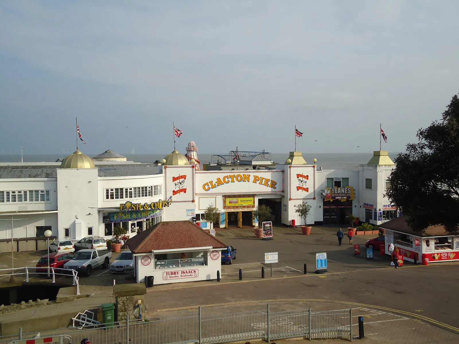
Clacton-on-Sea is in the area of Tendring District Council. It is a seaside town on the Tendring coast, quite unlike historic Colchester inland or the planned resort streets of Frinton-on-Sea to the north-east, with official conservation areas along the seafront and at Great Clacton, the older settlement behind the resort. The Clacton Seafront Conservation Area and the Great Clacton Conservation Area are the official features that shape topographical survey work here. Essex County Council is the Lead Local Flood Authority. There is no confirmed 2027 successor council for Essex.
In Clacton-on-Sea, including around the Clacton Seafront Conservation Area and around the Great Clacton Conservation Area, the same adopted local plan policies apply. Tendring District Council assesses site levels, flood risk and trees under Policy PPL 1 and Policy PPL 5 and Policy PPL 4 of the Tendring District Local Plan 2013-2033 and Beyond. A topographical survey is the usual way to record existing buildings, trees, boundaries and ground levels before a planning application is drawn up. Confirm the current validation requirements with the council before submitting.
Local plan: Tendring District Local Plan 2013-2033 and Beyond (The Tendring District Local Plan 2013-2033 and Beyond is the statutory development plan as of 15 November 2026. Section 1 was adopted in January 2021 and Section 2 was adopted on 25 January 2022.)
PPL 4: Biodiversity and Geodiversity
Policy PPL 4 (Biodiversity and Geodiversity) of the Tendring District Local Plan Section 2 protects sites designated for their international, European and national importance to nature conservation, and seeks a network of interconnected green and blue spaces that secures a net gain in biodiversity and geodiversity.
PPL 1: Development and Flood Risk
Policy PPL 1 (Development and Flood Risk) of the Tendring District Local Plan 2013-2033 and Beyond Section 2, adopted on 25 January 2022, sets the requirements for development within a flood zone, including Flood Zones 2 and 3 as defined by the Environment Agency.
PPL 5: Water Conservation, Drainage and Sewerage
Policy PPL 5 (Water Conservation, Drainage and Sewerage) of the Tendring District Local Plan Section 2 seeks to ensure that all new development makes adequate provision for drainage and sewerage and includes sustainable drainage systems.
PPL 11: The Area of Special Character, Frinton-on-Sea
Policy PPL 11 of the Tendring District Local Plan 2013-2033 and Beyond Section 2 identifies the Area of Special Character at Frinton-on-Sea, covering The Avenues.
General guidance for topographical survey, not formal advice for your site.
Tendring District Council. Essex County Council is the Lead Local Flood Authority. There is no confirmed 2027 successor council for Essex.
A topographical survey in Clacton-on-Sea is often needed to record levels and site features in the Clacton Seafront Conservation Area or around the Great Clacton Conservation Area before a planning application is drawn up. Confirm the current validation requirements with the council.
Accurate levels matter in the Clacton Seafront Conservation Area and around the Great Clacton Conservation Area, including on sites that may sit in areas of flood risk or where historic buildings and trees need to be recorded. Confirm the current validation requirements with the council.