Featured partner
Recommended for St Ives

ROAVR Group
Tree, ecology, flood risk and topographical surveys for planning applications.
4.9 Google rating
Get a quote
Local experts.
Featured partner
Recommended for St Ives
Tree, ecology, flood risk and topographical surveys for planning applications.
4.9 Google rating
Local experts.
Land and measured building survey practice whose own site publishes an address at 62…
Multidisciplinary consultancy whose own site publishes a Cambridgeshire office at…
Planning and surveying practice whose own site publishes a Cambridgeshire office at…
Land surveying practice, a division of SML Geospatial, whose own site publishes a head…
A topographical survey in St Ives is often needed where work could affect the St Ives Conservation Area, or the River Great Ouse. Huntingdonshire District Council is the local planning authority. Measured survey work is often used to record levels, trees and built form in the St Ives Conservation Area and at the River Great Ouse before a planning application is drawn up. It is a historic market town on the River Great Ouse around the official St Ives Conservation Area and the Town Bridge, quite unlike Huntingdon or St Neots. The adopted Huntingdonshire Local Plan to 2036 applies here. Confirm the current validation requirements with the council before submitting.
Local planning authority: Huntingdonshire District Council
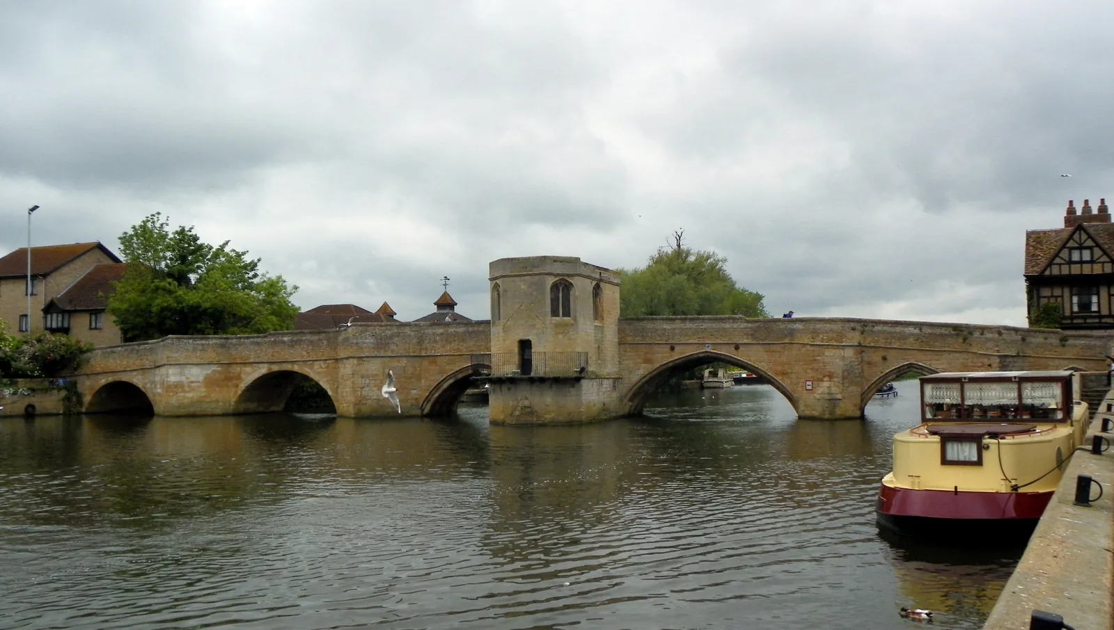
St Ives is in the area of Huntingdonshire District Council. It is a historic market town on the River Great Ouse around the official St Ives Conservation Area and the Town Bridge, quite unlike Huntingdon or St Neots. The adopted Huntingdonshire Local Plan to 2036 applies here. The St Ives Conservation Area and the River Great Ouse are the official features that shape topographical survey work here. Cambridgeshire County Council is the Lead Local Flood Authority. There is no confirmed successor council for Huntingdonshire.
In St Ives, including around the St Ives Conservation Area and at the River Great Ouse, the same adopted local plan policies apply. Huntingdonshire District Council uses topographical information to assess proposals around official features, including the St Ives Conservation Area and the River Great Ouse. Policy LP 31 (Trees, Woodland, Hedges and Hedgerows) of the Huntingdonshire Local Plan to 2036, adopted on 15 May 2019, requires a proposal to demonstrate that the potential for adverse impacts on trees, woodland, hedges and hedgerows has been investigated. Where investigations show that such adverse impacts are possible, a statement must assess the trees, woodland, hedges and hedgerows that would be affected and set out how adverse impacts will be avoided or, if unavoidable, minimised. A proposal will only be supported where it seeks to conserve and enhance any existing tree, woodland, hedge or hedgerow of value that would be affected, following the guidance in the Council's A Tree Strategy for Huntingdonshire (2015) or successor documents. Loss, threat or damage to any such feature of visual, heritage or nature conservation value will only be acceptable where the impact is first avoided, then minimised and then mitigated, or where there are sound arboricultural reasons. Confirm the current validation requirements with the council before submitting.
Local plan: Huntingdonshire Local Plan to 2036 (adopted)
LP 30: Biodiversity and Geodiversity
Policy LP 30 (Biodiversity and Geodiversity) of the Huntingdonshire Local Plan to 2036, adopted on 15 May 2019, requires a proposal to demonstrate that all potential adverse impacts on biodiversity and geodiversity have been investigated. A proposal that is likely to have a direct or indirect impact must be accompanied by an appropriate appraisal, such as a Preliminary Ecological Appraisal. All possible efforts must be taken to avoid adverse impacts; if unavoidable they must be minimised and then mitigated, with compensation only considered after that process. A proposal will only be supported subject to a hierarchy protecting internationally important sites, nationally important sites, and protected or priority species and habitats. The policy seeks no net loss in biodiversity and a net gain where possible. It does not set a higher than statutory biodiversity net gain percentage. Huntingdonshire District Council applies the statutory 10 per cent minimum.
LP 5: Flood Risk
Policy LP 5 (Flood Risk) of the Huntingdonshire Local Plan to 2036, adopted on 15 May 2019, provides that a proposal will only be supported where all forms of flood risk, including breaches of flood defences or other defence failures, have been addressed, as detailed in national planning practice guidance and with reference to the Cambridgeshire Flood and Water Supplementary Planning Document, such that the sequential approach and sequential test are applied and passed; the exception test is applied and passed if necessary; development has been sequentially located within the site to avoid flood risk; all reasonable opportunities to reduce overall flood risk have been considered and where possible taken; the integrity of existing flood defences is not adversely affected; and the requirements relating to flood risk in the Cambridgeshire Flood and Water SPD have been applied. Safety risks are determined on the basis that development should be safe for all for a 1:100 annual probability flood event, for the lifetime of the development, with appropriate climate change allowances.
LP 31: Trees, Woodland, Hedges and Hedgerows
Policy LP 31 (Trees, Woodland, Hedges and Hedgerows) of the Huntingdonshire Local Plan to 2036, adopted on 15 May 2019, requires a proposal to demonstrate that the potential for adverse impacts on trees, woodland, hedges and hedgerows has been investigated. Where investigations show that such adverse impacts are possible, a statement must assess the trees, woodland, hedges and hedgerows that would be affected and set out how adverse impacts will be avoided or, if unavoidable, minimised. A proposal will only be supported where it seeks to conserve and enhance any existing tree, woodland, hedge or hedgerow of value that would be affected, following the guidance in the Council's A Tree Strategy for Huntingdonshire (2015) or successor documents. Loss, threat or damage to any such feature of visual, heritage or nature conservation value will only be acceptable where the impact is first avoided, then minimised and then mitigated, or where there are sound arboricultural reasons.
General guidance for topographical survey, not formal advice for your site.
Huntingdonshire District Council. Cambridgeshire County Council is the Lead Local Flood Authority. There is no confirmed successor council for Huntingdonshire.
A topographical survey in St Ives is often needed to record levels, trees and built form in the St Ives Conservation Area or at the River Great Ouse before a planning application is drawn up. Confirm the current validation requirements with the council.
Accurate levels and feature locations help show how a proposal relates to the St Ives Conservation Area and the River Great Ouse, including trees, water and built form. Confirm the current validation requirements with the council.