Featured partner
Recommended for Brentwood

ROAVR Group
Tree, ecology, flood risk and topographical surveys for planning applications.
4.9 Google rating
Get a quote
Local experts.
Featured partner
Recommended for Brentwood
Tree, ecology, flood risk and topographical surveys for planning applications.
4.9 Google rating
Local experts.
Geospatial survey practice based at 92 Bellhouse Lane, Leigh-on-Sea.
Essex-based survey practice with its HQ at Mapline House, 14 Bull Lane, Rayleigh.
Measured and topographical survey practice with a trading office in Essex at The Old…
Survey practice based at Unit 5, Coptfold Hall Farm, Writtle Road, Margaretting, Essex,…
A topographical survey in Brentwood is often needed to record levels and site features in the Brentwood Town Centre Conservation Area or around the Weald Park Conservation Area before a planning application is drawn up. Brentwood Borough Council is the local planning authority. Accurate levels matter in the Brentwood Town Centre Conservation Area and around the Weald Park Conservation Area, including on sites that may sit in areas of flood risk or where trees and historic buildings need to be recorded. A topographical survey is the usual way to record existing buildings, trees, boundaries and ground levels. Confirm the current validation requirements with the council before submitting.
Local planning authority: Brentwood Borough Council
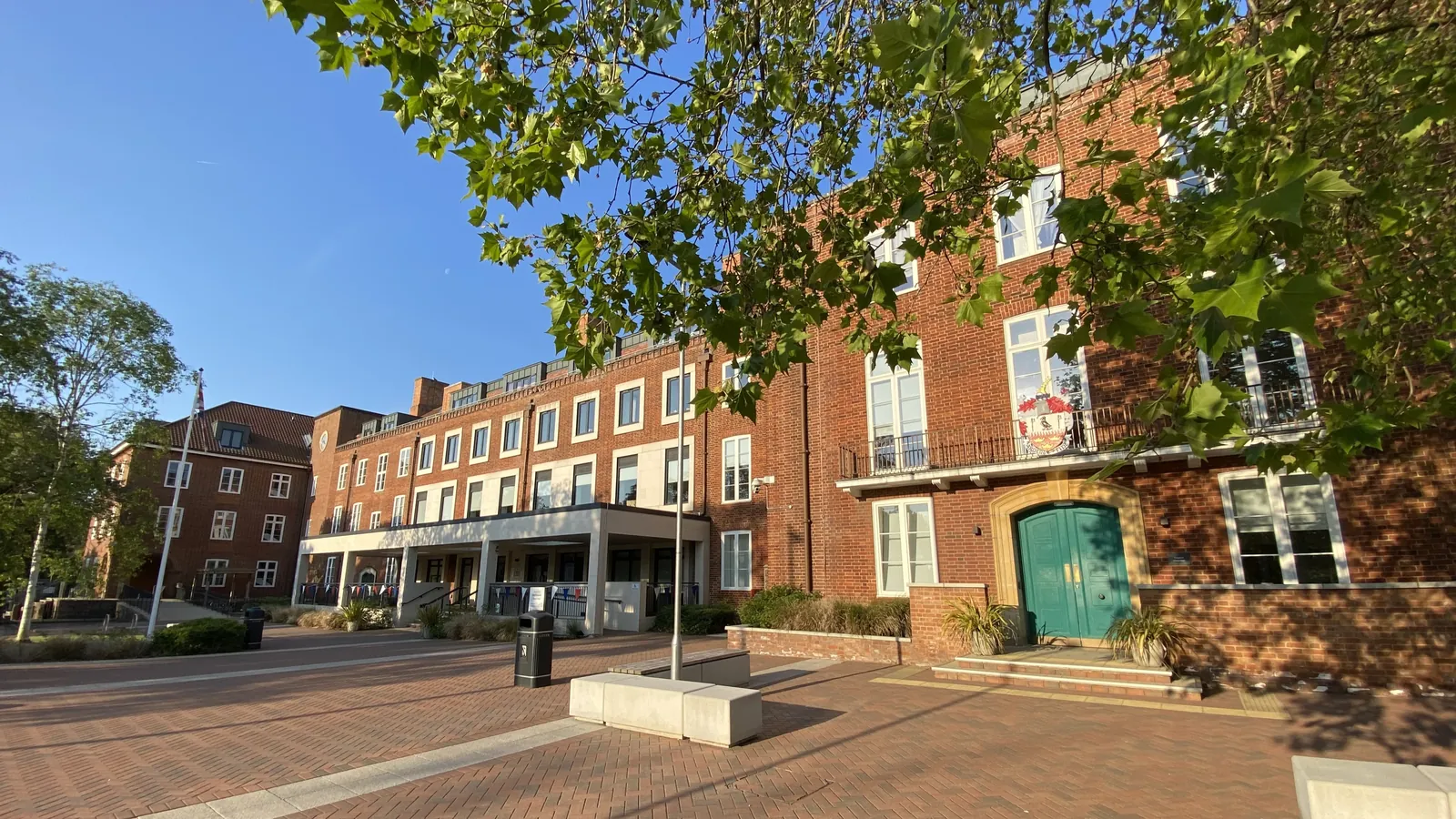
Brentwood is in the area of Brentwood Borough Council. It is a historic town in south-west Essex, just outside the M25, quite unlike the New Towns to the east or Harlow to the north, with the official Brentwood Town Centre Conservation Area and the official Weald Park Conservation Area on the west side of the town. The Brentwood Town Centre Conservation Area and the Weald Park Conservation Area are the official features that shape topographical survey work here. Essex County Council is the Lead Local Flood Authority. There is no confirmed 2027 successor council for Essex.
In Brentwood, including around the Brentwood Town Centre Conservation Area and around the Weald Park Conservation Area, the same adopted local plan policies apply. Brentwood Borough Council assesses site levels, flood risk and trees under Policy NE09 and Policy NE03 of the Brentwood Local Plan 2016-2033. A topographical survey is the usual way to record existing buildings, trees, boundaries and ground levels before a planning application is drawn up. Confirm the current validation requirements with the council before submitting.
Local plan: Brentwood Local Plan 2016-2033 (The Brentwood Local Plan 2016-2033 was adopted on 23 March 2022 and is the statutory development plan as of 15 November 2026.)
NE01: Protecting and Enhancing the Natural Environment
Policy NE01 (Protecting and Enhancing the Natural Environment) requires development proposals to protect and enhance the quality of the natural environment. All proposals should, wherever possible, incorporate measures to secure a net gain in biodiversity, protect and enhance the network of habitats, species and sites, and avoid negative impacts on biodiversity and geodiversity. Compensatory measures will only be considered if it is not possible fully to mitigate any impacts.
NE03: Trees, Woodlands, Hedgerows
Policy NE03 (Trees, Woodlands, Hedgerows) says development proposals that would result in the deterioration or loss of irreplaceable ancient woodland and ancient and veteran trees will not be permitted other than in wholly exceptional circumstances and only if the proposals include a suitable compensation strategy. In all other cases, proposals should, so far as possible and practicable, seek to retain existing trees, woodlands and hedgerows where they make a positive contribution to the local landscape, biodiversity or amenity.
NE09: Flood Risk
Policy NE09 (Flood Risk) requires new development to avoid areas of flood risk by applying the Sequential and, where necessary, the Exception Tests in accordance with national policy and guidance. A site-specific Flood Risk Assessment must assess all sources of flooding and demonstrate how flood risk will be managed over the development’s lifetime, taking climate change into account.
General guidance for topographical survey, not formal advice for your site.
Brentwood Borough Council. Essex County Council is the Lead Local Flood Authority. There is no confirmed 2027 successor council for Essex.
A topographical survey in Brentwood is often needed to record levels and site features in the Brentwood Town Centre Conservation Area or around the Weald Park Conservation Area before a planning application is drawn up. Confirm the current validation requirements with the council.
Accurate levels matter in the Brentwood Town Centre Conservation Area and around the Weald Park Conservation Area, including on sites that may sit in areas of flood risk or where historic buildings and trees need to be recorded. Confirm the current validation requirements with the council.
No other published town guides for this survey in the council area yet.