Featured partner
Recommended for Staines-upon-Thames

ROAVR Group
Tree, ecology, flood risk and topographical surveys for planning applications.
4.9 Google rating
Get a quote
Local experts.
Featured partner
Recommended for Staines-upon-Thames
Tree, ecology, flood risk and topographical surveys for planning applications.
4.9 Google rating
Local experts.
Environmental consultancy founded in 2004, with its head office on the Surrey Research…
Multi-disciplinary practice founded in 1985, offering arboriculture, ecology, landscape…
Farnham-based tree consultancy led by Alex Needs, a Chartered Arboriculturist and…
Independent arboricultural consultancy based near Fleet, led by Keiron Hart, who is…
Trees in the Staines Conservation Area and along the River Thames frontage are a frequent reason for a tree survey in Staines-upon-Thames. A planning application should record trees on and next to the site, usually to BS5837, so a layout can be designed around them. The local planning authority is Spelthorne Borough Council. Policy PS3 of the Local Plan 2024-2039/40, adopted on 17 March 2026, seeks to preserve and enhance landscape character and to use Tree Preservation Orders to protect significant trees, with a suitable replacement if a protected tree has to be felled. The Local List of Information Requirements, updated in June 2026, cites Policy PS3 as the driver for that survey.
Local planning authority: Spelthorne Borough Council
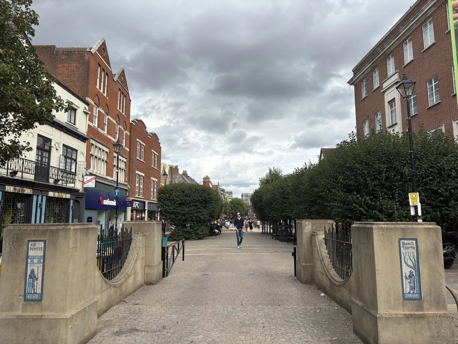
Staines-upon-Thames is a riverside market town just inside the M25, immediately east of junction 13. Policy SP1 highlights the Staines Conservation Area and the river frontage as defining character, so trees in Church Street, the High Street and along the Thames Path often sit in a heritage as well as a landscape setting. North of the town, Staines Moor and the Colne Valley Regional Park add a further landscape context. Sites beside the River Thames, River Colne or Sweeps Ditch may also need an 8 m main-river buffer under Policy SP6, which a tree and topographical survey should pick up early.
Spelthorne Borough Council assesses tree and landscape issues under Policy PS3 of the Local Plan 2024-2039/40, adopted on 17 March 2026, and under Policy SP1 where a proposal affects the Staines Conservation Area or the river frontage. The Local List of Information Requirements (updated June 2026) requires a survey of all trees on the site, to BS5837, where Policy PS3 is engaged. Confirm the current list with the council before submitting.
Local plan: Spelthorne Local Plan 2024-2039/40 (Adopted at Extraordinary Council on 17 March 2026. The Local List of Information Requirements was updated in June 2026.)
SP5: Colne Valley Regional Park
Policy for the Colne Valley Regional Park, covering the Colne corridor and Staines Moor to the north of the town.
SP1: Staines-upon-Thames
Area strategy for the borough's main town centre. Requires flood risk management and green and blue infrastructure to be incorporated where appropriate, and expects development affecting the Staines Conservation Area or the river frontage to respect and enhance that character. Supports riverside public realm, landscaping and SuDS.
E1: Green and Blue Infrastructure
Requires all development to contribute to the green and blue infrastructure network at a commensurate scale. Proposals on or adjacent to a watercourse or reservoir must protect and enhance ecological, flood risk, landscape and recreational value, consistent with the Water Framework Directive.
E2: Biodiversity
Supports habitat connectivity and habitat creation, particularly in Biodiversity Opportunity Areas including Staines Moor to Shortwood Common. Seeks at least 10 per cent biodiversity net gain, delivered first on site, then close to the site, then within the borough where feasible. Protects Ramsar, SPA and SSSI units forming the South West London Waterbodies network, and local SNCIs, LNRs, ancient and veteran trees and TPOs.
E3: Managing Flood Risk
Guides development to the lowest flood risk from all sources through the sequential test, with the exception test where national policy requires it. Requires SuDS unless they are not appropriate, greenfield runoff rates on new development, and site-specific flood risk assessment in Flood Zones 2 and 3a and on dry islands, including safe access and egress and climate change. Safeguards the River Thames Scheme channel through the borough. Basement extensions and conversions to a higher vulnerability in the floodplain are not permitted.
PS3: Heritage, Conservation and Landscape
Seeks to preserve and enhance architectural, historic and landscape character. Includes conservation areas, listed buildings, archaeology, and the effective use of Tree Preservation Orders to protect significant trees, with replacement required if a protected tree has to be felled. The June 2026 Local List cites Policy PS3 as the driver for tree surveys.
SP6: River Thames and its Tributaries
Protects the setting of the River Thames and the Rivers Ash, Colne and Wraysbury. Requires no new culverting, retained natural banks, undeveloped buffer zones of at least 8 m for main rivers and 5 m for other watercourses (including culverted rivers), and supports the River Thames Scheme, including a new footpath connection at Laleham.
General guidance for tree survey (bs5837), not formal advice for your site.
Spelthorne Borough Council. From 1 April 2027 planning powers pass to the new West Surrey unitary council under local government reorganisation.
The Local List of Information Requirements, updated in June 2026, requires a survey of trees on the site, referring to BS5837, where Policy PS3 is engaged. Confirm the current list with the council, including any diameter threshold and whether an impact assessment and protection plan are also needed.
Yes. Policy SP6 requires an undeveloped buffer of at least 8 m from main rivers, including the River Thames and its tributaries, and Policy SP1 protects the character of the Staines Conservation Area and the river frontage. A tree survey should be coordinated with any flood risk and ecological work on those sites.