Featured partner
Recommended for Victoria

ROAVR Group
Tree, ecology, flood risk and topographical surveys for planning applications.
4.9 Google rating
Get a quote
Local experts.
Featured partner
Recommended for Victoria
Tree, ecology, flood risk and topographical surveys for planning applications.
4.9 Google rating
Local experts.
Measured building and land surveyors trading from 111 Gosterwood Street in Deptford, in…
Land and measured-building survey practice with a London office in Crystal Palace.
Land and building surveying company with offices in Surrey (Dunsfold Park), London,…
Land survey and site engineering practice based in Chesham, north-west of the M25.
An accurate topographical survey of levels, trees, buildings and boundaries is the usual base plan for a BS 5837 tree survey and for drainage design in Victoria. Along Victoria Street, around Westminster Cathedral and toward the River Thames, it shows how a proposal sits on tight civic plots, where basement levels relate to the street and the embankment, and how overland flow or a tidal breach would move. Westminster City Council expects trees of amenity or townscape value to be plotted and protected, and it requires flood risk from all sources, including surface water flood risk, to be understood from the outset. Flood risk assessments and SuDS schemes depend on reliable levels.
Local planning authority: Westminster City Council
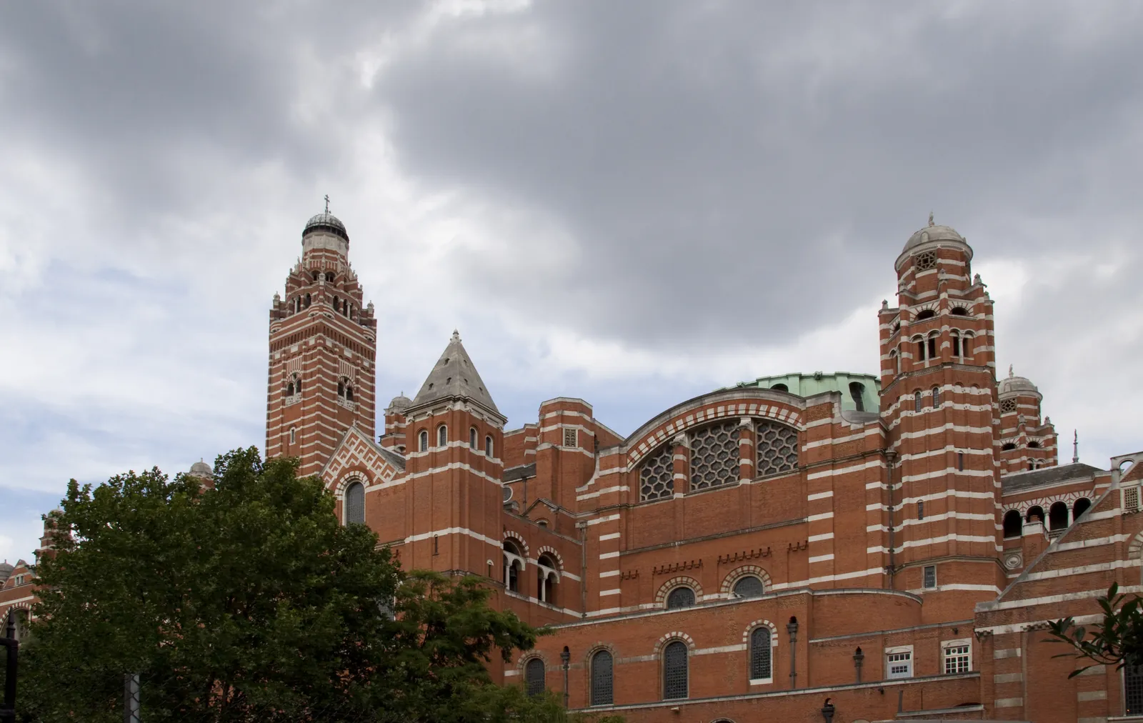
Sites along Victoria Street, around Westminster Cathedral and toward the River Thames need accurate levels and tree positions. A topographical survey supports Policy 34 and the flood-risk work required under Policy 35, including surface water flood risk and the proximity of tidal defences.
Westminster City Council relies on accurate site information to apply Policy 34 on green infrastructure and trees and Policy 35 on flood risk and drainage in the City Plan 2019–2040, adopted on 21 April 2021. Confirm the current local validation requirements with the council before submitting.
Local plan: City Plan 2019–2040 (Westminster's City Plan 2019–2040 was adopted on 21 April 2021 and is the adopted local plan. A later partial review is not treated as adopted. The London Plan, published on 2 March 2021, also forms part of the development plan. There is no 2027 successor council for this borough.)
34: Green infrastructure
Policy 34 of the City Plan 2019–2040, adopted on 21 April 2021, protects and enhances Westminster's green infrastructure. Developments will, wherever possible, contribute to the greening of the city by incorporating trees, green walls, green roofs, rain gardens and other green features. Sites of Importance for Natural Conservation, priority habitats and other ecological features outside the SINC network will be protected. Developments should achieve biodiversity net gain, wherever feasible and appropriate, and should maximise opportunities to enhance existing habitats and create new habitats for priority species. The policy does not set a percentage above the statutory 10 per cent minimum. Trees of amenity, ecological and historic value, and those which contribute to the character and appearance of the townscape, will be protected. The planting of trees to optimise the city's canopy cover will be encouraged in new developments. Supporting text says the loss of such trees should be prevented, and that proposals for new trees should have regard to the Trees and the Public Realm SPD.
35: Flood risk
Policy 35 requires all developments to be safe for their lifetime from the risk of flooding, complying with the council's Strategic Flood Risk Assessment, Surface Water Management Plan, Local Flood Risk Management Strategy and the Mayor's Regional Flood Risk Appraisal. A site-specific flood risk assessment must be submitted for developments of 1 hectare or greater, all developments in Flood Zones 2 and 3, and all developments within a Surface Water Flood Risk Hotspot. Highly Vulnerable Uses will not be allowed in Flood Zone 3. Within the Rapid Inundation Zone, basement dwellings and basement extensions to existing dwellings will not be acceptable. An undeveloped buffer zone of 16 metres should be maintained around flood defence structures wherever possible. New development must incorporate Sustainable Drainage Systems, should aim to achieve greenfield run-off rates, and should demonstrate how all opportunities to minimise site run-off have been taken.
General guidance for topographical survey, not formal advice for your site.
The Westminster City Council. The London Plan also forms part of the development plan. The borough is the Lead Local Flood Authority. There is no 2027 successor council for this borough.
It supports the tree protection expected under Policy 34 and the flood risk and drainage work required by Policy 35, especially along Victoria Street, around Westminster Cathedral and toward the River Thames.
Yes. The London Plan, published on 2 March 2021, forms part of the development plan. Policy G7 and Policies SI12 and SI13 are the London Plan policies most often read alongside a site survey.
No other published town guides for this survey in the council area yet.