Featured partner
Recommended for Wood Green

ROAVR Group
Tree, ecology, flood risk and topographical surveys for planning applications.
4.9 Google rating
Get a quote
Local experts.
Featured partner
Recommended for Wood Green
Tree, ecology, flood risk and topographical surveys for planning applications.
4.9 Google rating
Local experts.
Land and building surveying company with offices in Surrey (Dunsfold Park), London,…
Measured building and land surveyors trading from 111 Gosterwood Street in Deptford, in…
Land and measured-building survey practice with a London office in Crystal Palace.
Land survey and site engineering practice based in Chesham, north-west of the M25.
An accurate topographical survey of levels, trees, buildings and boundaries is the usual base plan for a tree survey and for drainage design in Wood Green. Along Wood Green High Road, around Haringey Civic Centre and beside Ducketts Common, it shows how a proposal sits relative to street trees, the common and overland flow routes. The London Borough of Haringey expects existing trees to be protected and maintained, and it requires surface water to be managed from the outset. Surface water flood risk assessments and SuDS schemes depend on reliable levels, kerb lines and the position of existing drains and soft landscape.
Local planning authority: London Borough of Haringey
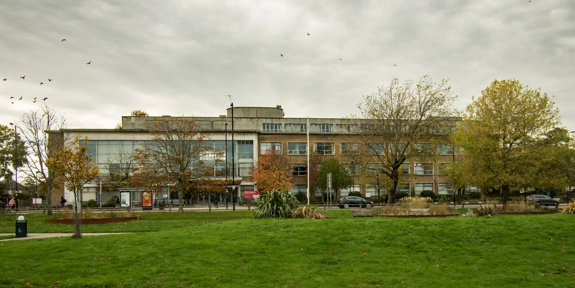
Sites on Wood Green High Road, around Haringey Civic Centre and beside Ducketts Common need accurate levels and tree positions. A topographical survey supports Policy SP13 and the flood-risk work required under Policies DM24 and DM25, including surface water flood risk.
The London Borough of Haringey relies on accurate site information to apply Policy SP13 on trees and biodiversity and Policies DM24 and DM25 on flood risk and drainage. Confirm the current local validation requirements with the council before submitting.
Local plan: Haringey's Local Plan: Strategic Policies 2013–2026 (consolidated with alterations since 2017) and Development Management DPD (Haringey's Strategic Policies (2013, with 2017 alterations) and the Development Management DPD were adopted on 24 July 2017 and remain the adopted borough-wide local plan. The London Plan, published on 2 March 2021, also forms part of the development plan. There is no 2027 successor council for this borough.)
SP13: Open Space and Biodiversity
Policy SP13 of Haringey's Strategic Policies, adopted on 24 July 2017, requires new development to protect and improve the borough's parks and open spaces and to protect and improve sites of biodiversity and nature conservation, including private gardens. This includes a contribution to wildlife and ecological habitats; the protection, management and maintenance of existing trees and the planting of new trees where appropriate; and the protection, enhancement and creation of Sites of Importance for Nature Conservation and Local Nature Reserves. The policy does not set a biodiversity net gain percentage above the national minimum.
DM19: Nature Conservation
Policy DM19 of the Development Management DPD, adopted on 24 July 2017, requires development on or adjacent to internationally designated sites, Sites of Special Scientific Interest, Local Nature Reserves, Sites of Importance for Nature Conservation or Ecological Corridors to protect and enhance the nature conservation value of the site. Development with a direct or indirect adverse impact upon important ecological assets is only permitted where the harm cannot reasonably be avoided and appropriate mitigation can address the harm caused. Supporting text expects proposals to seek opportunities to enhance biodiversity wherever possible.
DM24: Managing and Reducing Flood Risk
Policy DM24 requires all proposals for new development to avoid and reduce the risk of flooding to future occupants and not to increase the risk of flooding. Proposals in Flood Zones 2 and 3a must provide evidence for the Sequential and, where required, Exception Tests, informed by a site-specific flood risk assessment taking account of all sources of flooding. All new development must manage and reduce surface water run-off and manage water and waste water discharges. Development in Flood Zone 3b is not permitted except for water-compatible uses and essential infrastructure. Policy DM25 requires surface water to be managed as close to its source as possible. Major development must reduce surface water flows to a greenfield run-off rate for a 1 in 100 year critical storm event; minor development should aim for greenfield rates and, at a minimum, a 50 per cent reduction on existing site run-off rates. Policy SP5 requires all development to reduce all forms of flood risk and to implement Sustainable Drainage Systems.
General guidance for topographical survey, not formal advice for your site.
The London Borough of Haringey. The London Plan also forms part of the development plan. The borough is the Lead Local Flood Authority. There is no 2027 successor council for this borough.
It supports the tree protection expected under Policy SP13 and the flood risk and drainage work required by Policies DM24 and DM25, especially on Wood Green High Road and beside Ducketts Common.
Yes. The London Plan, published on 2 March 2021, forms part of the development plan. Policy G7 and Policies SI12 and SI13 are the London Plan policies most often read alongside a site survey.
No other published town guides for this survey in the council area yet.